
City of Athens
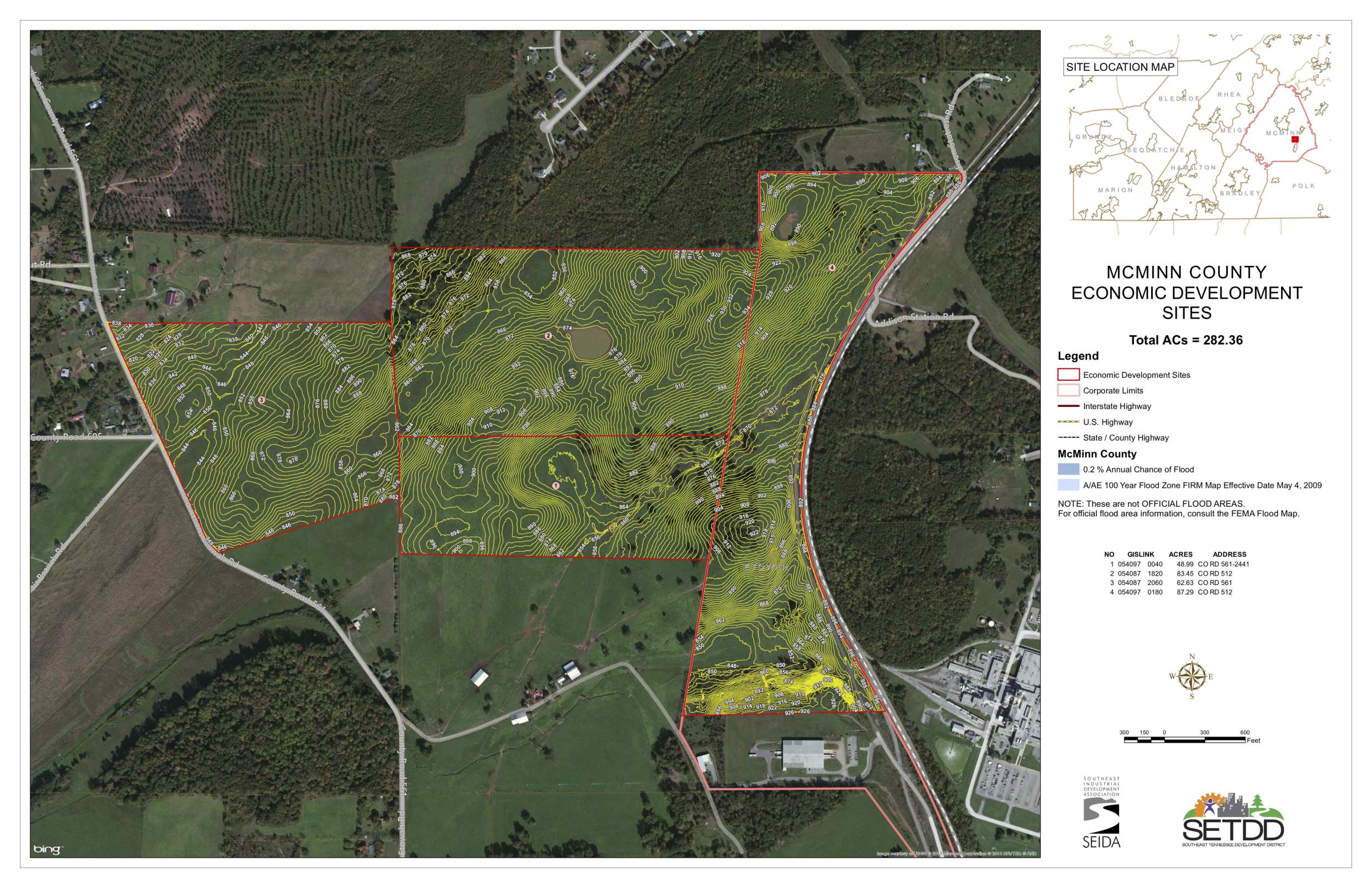
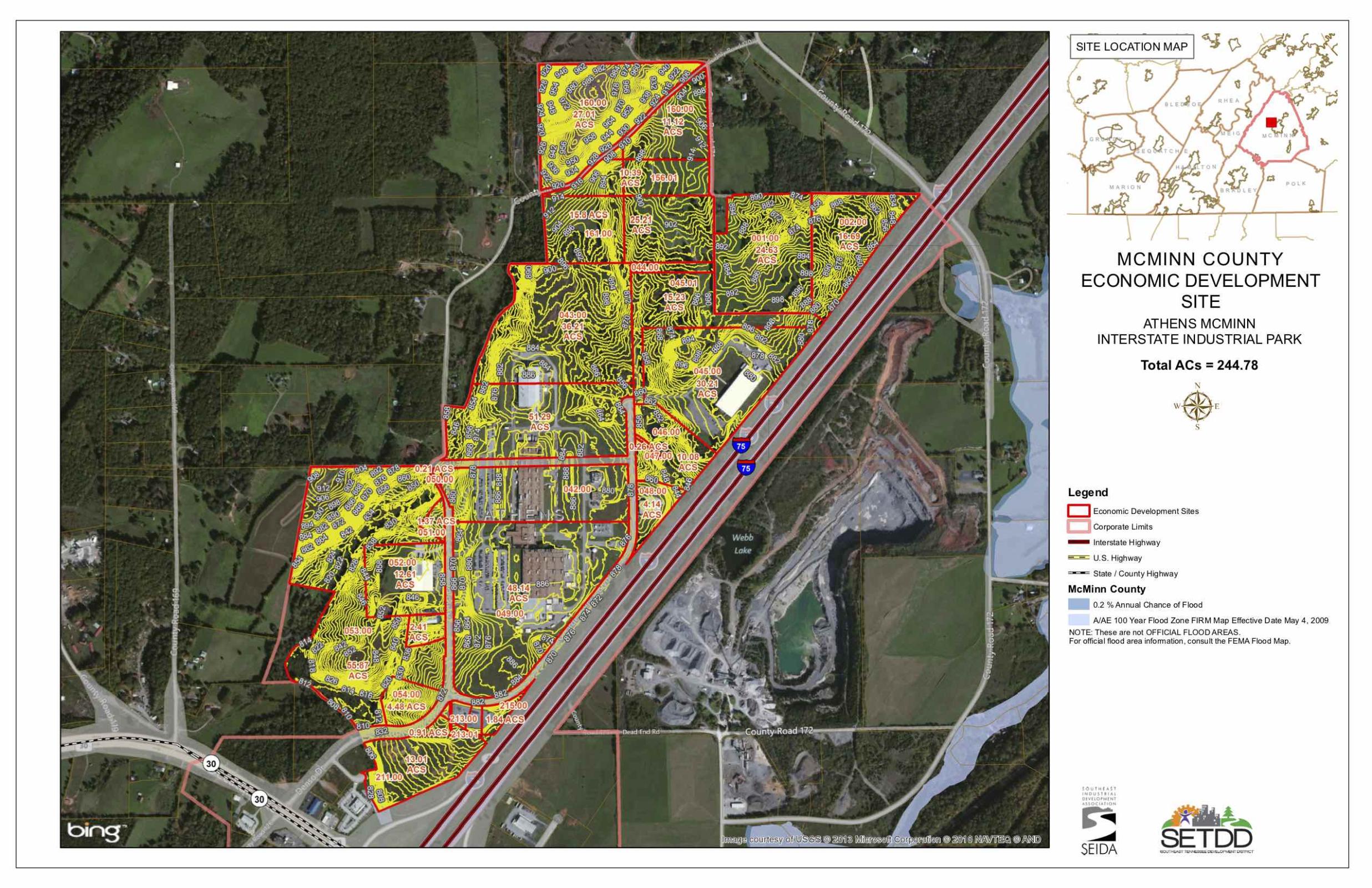
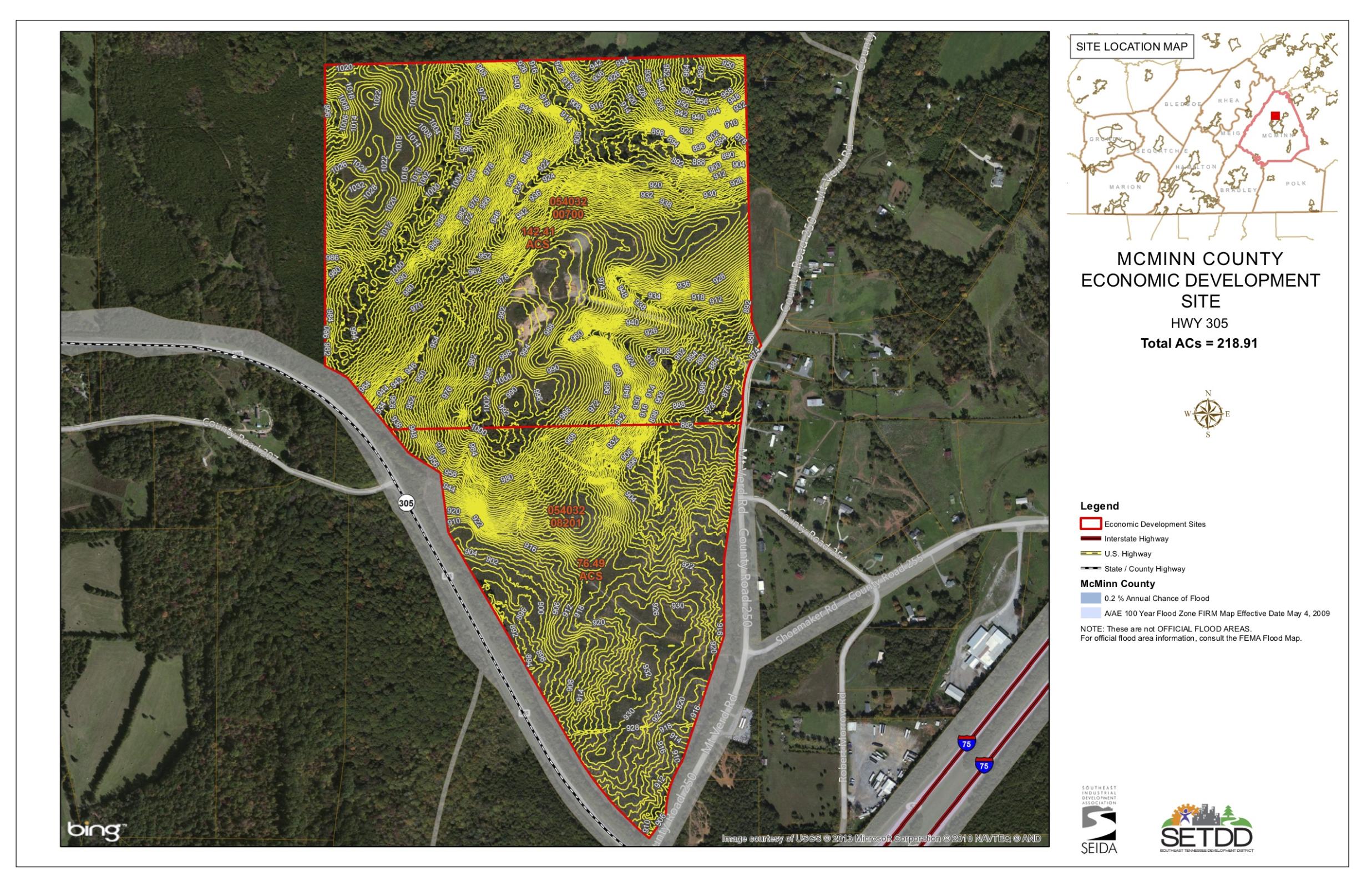
 The McMinn County Economic Development Authority publicly owns property in three McMinn County Industrial Certified Sites.
McMinn County is a proud participant in Tennessee’s Certified Sites Program, designed to prepare certified sites for corporate investment. This program is ranked number one in the country by Area Development for Site-Readiness Programs. All parks have the appropriate zoning for industrial uses. Each site offers rail service and has a close proximity to Interstate 75 which, taken together, provides quick, reliable access to the worldwide supply chain.
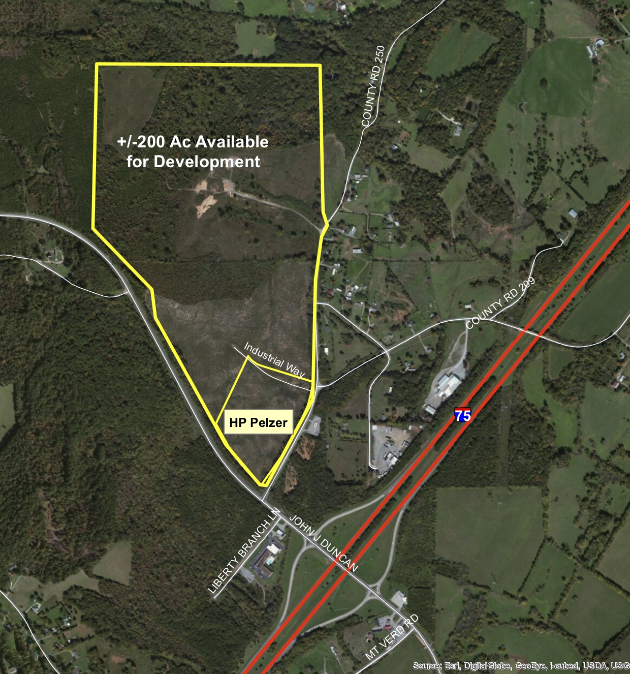
The 75 Regional Commerce Park is a 177 acre privately owned business park with 150 acres dedicated to industrial uses. The site is located adjacent to Interstate 75. Excellent location located mid-way between Chattanooga and Knoxville. Distribution and logistics companies would be ideal for this interstate visible and accessible site.

Park Facts:
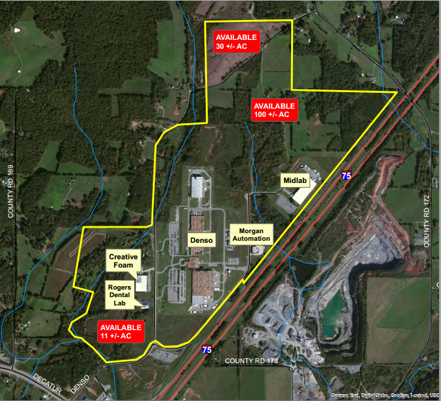

Park Facts:
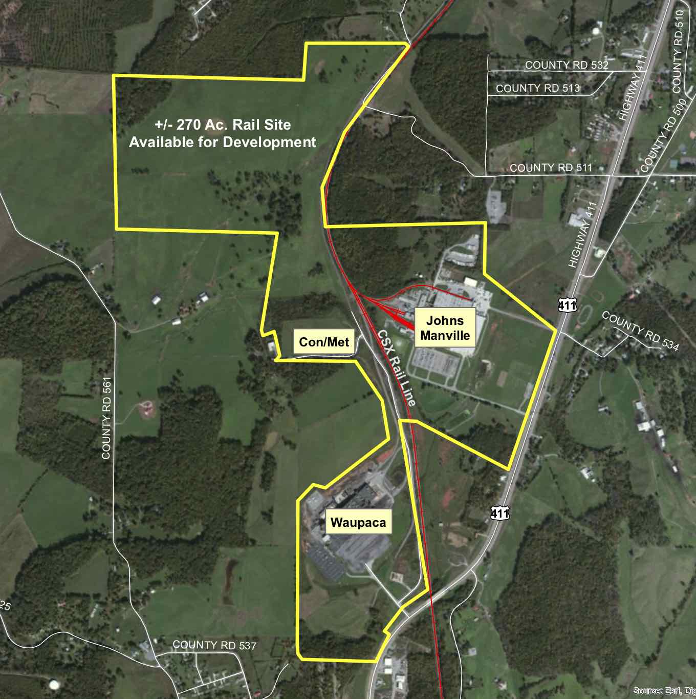
 This park is CSX Select Site and Select Tennessee Certified! Of the total 600 acres, 272 are available for development, with the largest contiguous tract available is 208 acres. The site is certified by Austi Consulting & Foote Consulting, with the program minimizing development risk. Declaration of Covenants, Conditions and Restrictions can be viewed here
Park Facts: